Cooler weather is coming and so are its threats to aircraft.
Cloud identification assists in avoiding turbulence, thunderstorms, and icing. Icing holds major hazards for airmen, so we have dedicated this blog to identifying the greatest potential icing conditions and how you can avoid them. Keep reading to learn about in-flight icing and how you can combat this flying foe.Ice hazards to aircraft.
Fronts and low-pressure areas are the greatest ice potential as far as optimal icing weather conditions are concerned. However, some isolated air masses can produce a substantial amount of ice in clouds making light aircraft flight inadvisable. The largest amount of ice accumulation on aircraft happens at and between -4 degrees F to 32 degrees F (-20 degrees C to 0 degrees C). When icing accumulates on aircraft in-flight, this:- Eliminates smooth flow of air
- Increases weight and drag
- Decreases airfoil needed for lift
- Decreases thrust
- Creates low visibility
- Creates weight imbalance, particularly for rotor-wing aircraft
In-flight icing potential.
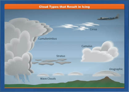
Clouds that hold the potential for icing include: Cirrus, cumulonimbus, cumulus, stratus (particularly lake-effect stratus clouds), orographic, and wave clouds. Whether or not a cloud will produce icing is dependant on the outside temperature and the amount of moisture within the cloud. Fronts also pose the risk of icing. Along a warm front, warm air mixes with cooler air to form stratus clouds conducive to icing. Along a cold front, the colder air mass lifts the warmer air, creating cumulus clouds conducive to icing. If you have to fly through a front, it’s important to remember to take the shortest route possible, so as to minimize exposure to potential icing conditions. Ice fog is another icing hazard that can affect aircraft. It only occurs when temperatures are much below freezing (usually -25 degrees F or colder), causing moisture in the air to super freeze and form ice crystals. This condition usually happens early morning or at night and when there is a small temperature to dew point spread. There is usually little to no wind and a clear sky when ice fog occurs. It is mostly found in the arctic region, but has been known to happen in the middle latitudes during the cold season. Ice fog holds another danger on top of the normal icing hazards as it can blind aviators when flying into the sun. Check temperature and dew point conditions before taking off or landing to ensure you will not be encountering any ice fog.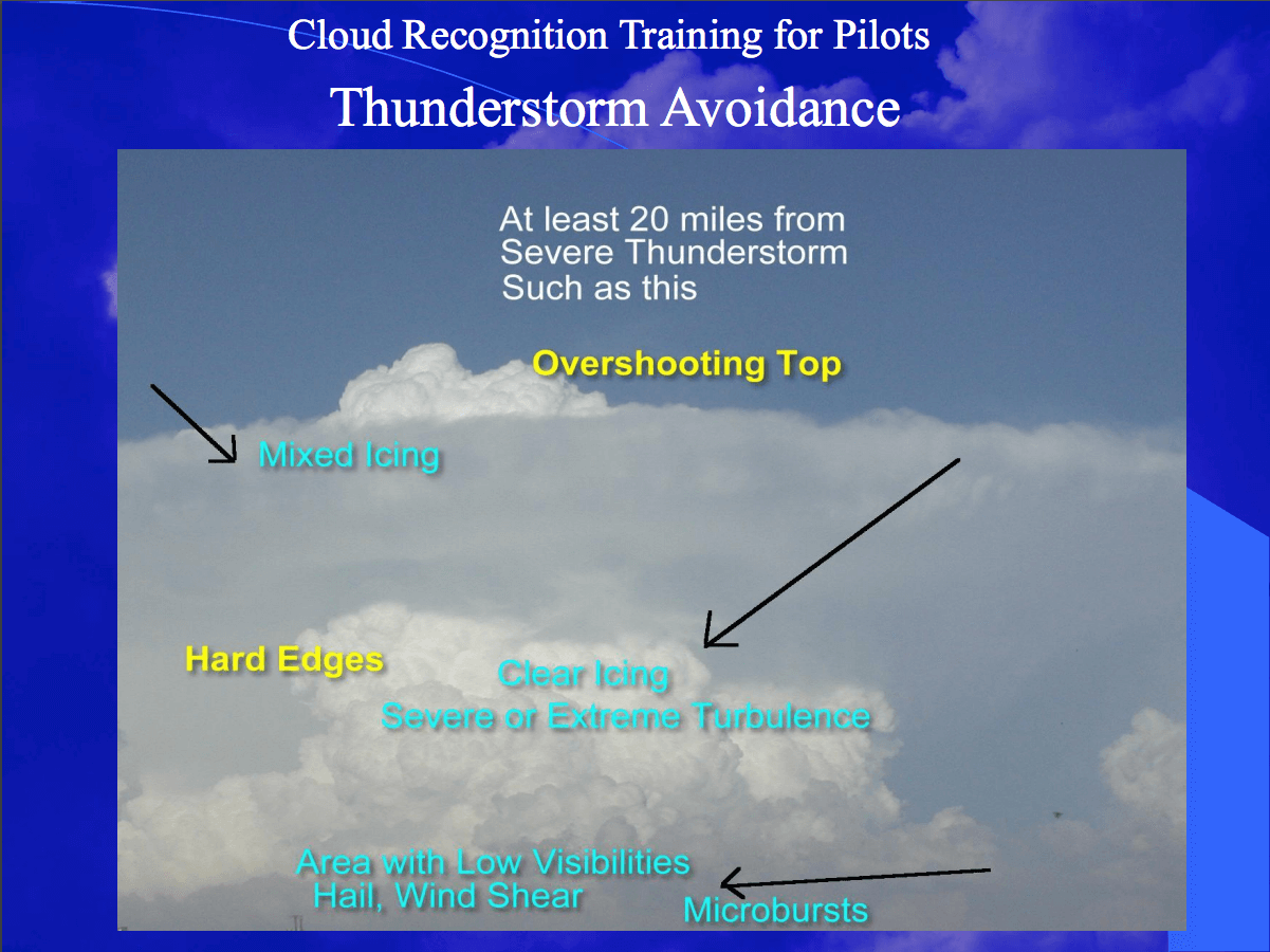 (From the Southwest Aviation Weather Safety Workshop 2010 Aviation Hazard Awareness Training, Cloud Recognition Training for Pilots slideshow on weather.gov)
Icing avoidance.
The best way to avoid and stay safe during an icing situation is to –- Know your aircraft: anti/de-icing systems, approved for known-icing? How long will your TKS fluid last in varying icing conditions, etc.
- Know your flightpath surroundings: where fronts are and are moving, where are the cloud tops and bases, where are your nearest outs, etc.
- Know your limitations: can you climb above or go around any potential threats?
- Check up on pireps: get as much info from your fellow airmen as you can.
RELATED READING
RELATED CTS TRAINING

